

 SLOVAK (SK)
 ENGLISH (UK)
 RUSSIAN (RU)
 CZECH (CZ)
.jpg)
More detailed instructions how to work with the program PointCAB can be found on our Youtube profile.
 |
Layout Create ortho photo layouts and sections |
 |
Mesh Extract meshed digital 3D terrain models (DTM) |
 |
Section Create ortho photo layouts and sections |
 |
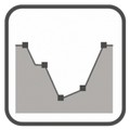
Volume Create volume calculation protocols according to REB 22013 |
 |
Merger Create scaled images for documentation or use in a 3D CAD system |
 |
Delta Analyze and protocol deviations of evenness |
 |
Panorama Create panoramic views from any desired position of a project |
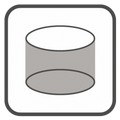 |
Unfold Unfold, analyze and protocol cylindrical objects |
 |
Webexport Create interactive HTML or static PDF documentations |
 |
Pointcloud Export Export specific parts of your point cloud |
 |
Vectorizer Vectorize plans created based on your point cloud |
 |
Sketch Create measurements of angles, distances and surfaces, dimensioning and annotations |
 |
Profiler Create profile lines in an elevation model of the point cloud |
 |
Photomatch Match high-resolution images onto sections and layouts |