SLOVAK (SK)
 ENGLISH (UK)
 RUSSIAN (RU)
 CZECH (CZ)
.jpg)
The investor's intention regarding the building at Bottova Street 11 was an extensive renovation.The Renaissance burgher house was built in the first half of the 16th century.It was later modified in the 19th and 20th centuries. The two-storey house has a two- and three-section layout, an L-shaped floor plan and a basement.The passage terraced house is located on the east side of the street in the Municipal Monument Reserve in the immediate vicinity of Mariánske námestie square in Žilina.
Measuring the house required to find out the dimensions, deviation from perpendicular, heights, deflections of structures and exact arches measurements. Therefore, the investor decided to use the 3D Terrestrial Laser Scanning method.

Measurement of the historical building using the 3D laser scanning method
Sample photo, Source: iQservices
The advantage of a point cloud is the application of the GPS coordinate system, related to the demarcation points of the surveyors. Using this method, the entire building can be accurately positioned in the cadastral map.In this case we found a displacement of the building in the part of the common wall towards the object on the south side of the land plot.

Point cloud created using a terrestrial laser scanner, Source: iQservices
The architect’s design considered to utilize the attic space and create housing premises. An advantage of 3D terrestrial laser scanningis a representation of height variances that are very difficult for a person in charge to measure in usual "measurement" work.During the measurement we found the attic floor sloping, as well as deflections of the tie beams and rafters.

Illustration of the ground floor displacement to the adjacent land plot, Source: iQservices

Deformations of the structure, Source: iQservices
A single model is created when scanning an object. Therefore, all structures, even hidden or otherwise immeasurable, can be precisely positioned in the correct place within the object.

Positioning of part of the basement against the ground floor, Source: iQservices
Measuring a complex object using 3D terrestrial laser scanning can avoid unforeseen inaccuracies and complications in further work on the construction site. It also shortens the time to elaborate documentation of the actual condition of structures.

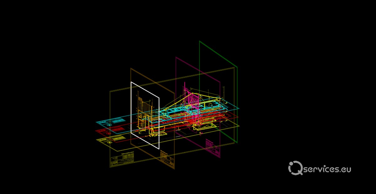
Finished drawing based on the point cloud, Source: iQservices
oint cloud processing software is used to work with the data.The software processes a complex point cloud into an understandable form.The processed data is projected into the plane (floor plans, sections, views). A Faro Focus S350 3D terrestrial laser scanner was used for capturing.
The resulting product is the real captured dimensions of the building – layout, floor plans, sections and views in the final output in DWG and .PDF formats.

Finished drawing based on the point cloud, Source: iQservices
Authors: Ing. Dušana Andrásová, Ing. Lukáš Dobroň