News
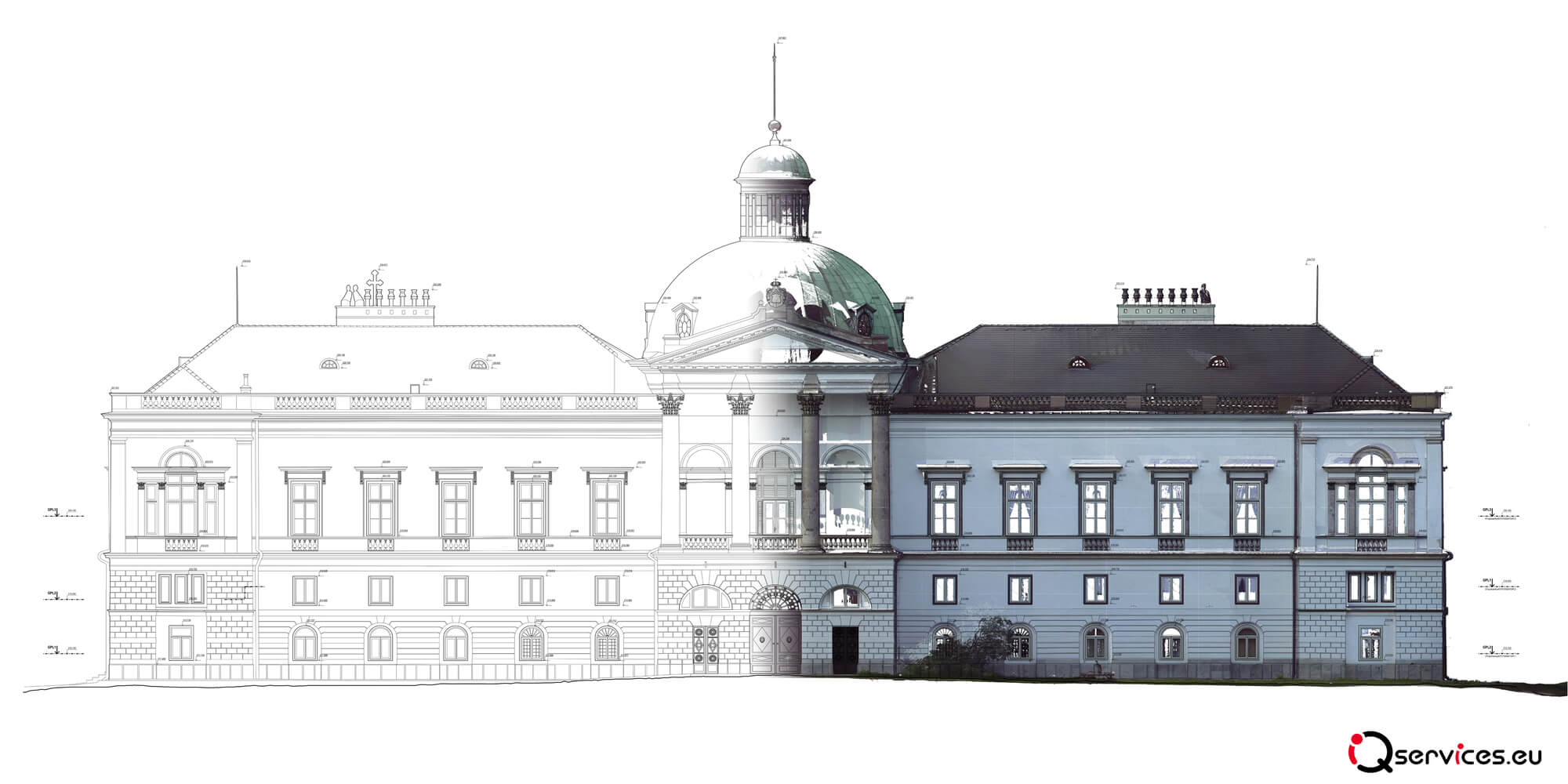
Fact-finding is an essential process in construction, architecture and industry that ensures accurate digital capture of existing objects and spaces. It is used to update

Fact-finding is an essential process in construction, architecture and industry that ensures accurate digital capture of existing objects and spaces. It is used to update
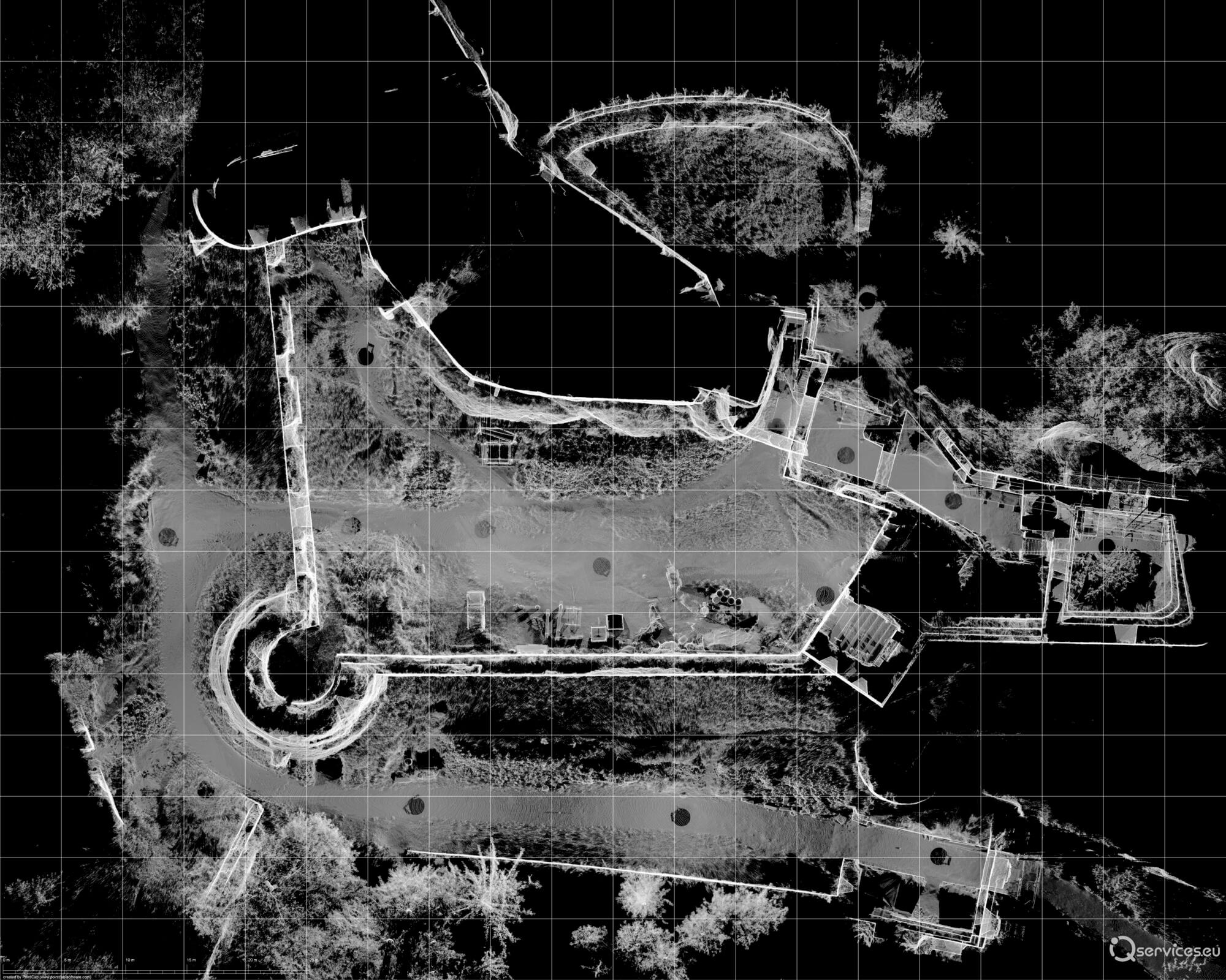
What is a point cloud? A point cloud is a digital representation of a physical object or space created by 3D laser scanning. It is
Does the laser scanning save the Lietava castle? Main page News Does the laser scanning save the Lietava castle? Modern technology has developed an enormous
Digital technologies as a support for strategic decisions Main page News Digital technologies as a support for strategic decisions Modernize, expand, optimize and subsequently introduce
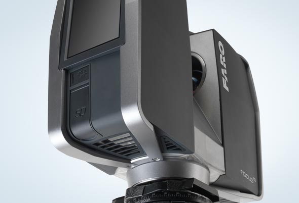
The scanner FARO Focus3D was awarded Main page News The scanner FARO Focus3D was awarded At the exhibition DEUBAU 2012 the architecture magazines AIT and
iQservices has supported regional projects again Main page News iQservices has supported regional projects again When we started a pilot project for preservation of cultural
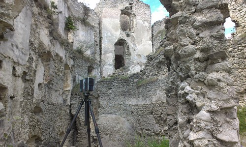
The Scanning of the Lietava Castle by color laser scanner FARO Focus 3D Main page News The Scanning of the Lietava Castle by color laser
From university to business Main page News From university to business A few young men from the University of Žilina have started to be interested

Laser Scanner Faro Focus X130 and Faro Focus X330 Main page News Laser Scanner Faro Focus X130 and Faro Focus X330 After the huge sales
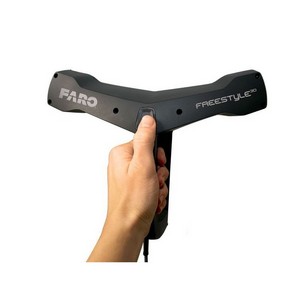
Faro Freestyle3D handheld scanner Main page News Faro Freestyle3D handheld scanner In early 2015 the company introduced a new scanner Faro Faro Freestyle3D. It is